


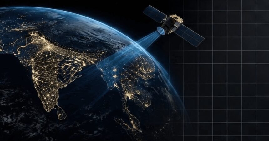
Every day, Earth-observation satellites photograph the planet in staggering detail — wildfires igniting, rivers flooding, ships moving through dark waters. Most of that imagery never gets looked at. It sits in archives while the events it captured unfold on the ground, because beaming it all down to Earth is slow, expensive, and clogged with pictures of clouds. A Bengaluru startup decided the answer was not a bigger pipe to the ground. It was to teach the satellite to think for itself.
SkyServe was founded in 2020 by Vinay Simha, Vishesh Vatsal and Adithya Kothandhapani, three engineers who had spent years together at Team Indus building India’s first private lunar rover and lander for the Google Lunar XPRIZE. Deep-space missions take years to pay off, so the trio turned their spacecraft know-how towards Earth observation, where artificial intelligence was opening a new frontier. Their bet: the satellites already in orbit could become far more useful if the intelligence lived aboard them.
STORM: the brain that rides along
At the heart of SkyServe is STORM, an edge-computing platform that runs AI models directly on the satellite. Instead of streaming every raw frame to the ground, the satellite analyses what it sees in orbit — correcting errors in the imagery, removing cloud and water cover, identifying vegetation and picking out the features that matter — and sends down only the insight. A companion ground platform called SURGE lets customers develop, test and deploy their own AI models onto the fleet. The company says the approach makes each orbit cover more ground, cuts bandwidth costs dramatically, and turns days of waiting into minutes.
Building that was not a matter of shrinking a data-centre model onto a chip. Satellites run on tight power and memory budgets, in radiation and thermal extremes, so every model has to be compressed and hardened to survive the environment. That engineering — squeezing advanced AI into a package that keeps working hundreds of kilometres up — is the breakthrough the company is built on.
Proven in orbit, from Sinai to the Indian Ocean
The proof came in April 2024, on a mission the company calls Matterhorn. Working with space logistics company D-Orbit, SkyServe uplinked STORM to a satellite launched by SpaceX and put it to work over the Egypt-Sinai Peninsula. Within seconds of capturing a vast area, the onboard software corrected errors in the imagery, stripped out cloud and water cover and identified vegetation — and, the company says, sent back memory-efficient imaging five times leaner than the raw feed. Co-founder and CEO Vinay Simha called it the iPhone moment for Earth observation: the point at which a satellite stops being a camera and starts being a computer.
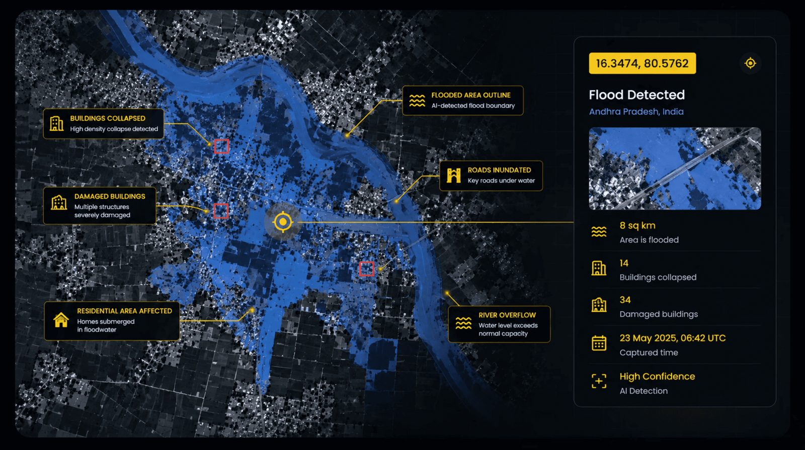 STORM’s flood-detection output over Andhra Pradesh: 8 sq km flooded, 14 buildings collapsed, mapped in minutes. Image: SkyServe.
More Read

The missions kept coming. On Mission Denali, STORM flew aboard Loft Orbital’s YAM-6 satellite to demonstrate automated tasking and host customer geospatial models. In March 2025, SkyServe began working with scientists at NASA’s Jet Propulsion Laboratory, testing AI models built under NASA’s New Observations Strategies programme — models designed to watch for wildfires, floods and urban heat islands — on a D-Orbit ION satellite carrier in low Earth orbit. D-Orbit has since moved to equip its ION carriers with STORM, Loft Orbital has installed SkyServe’s edge computer on its spacecraft, and another STORM rides as a hosted payload on a SatRevolution cubesat launched on an Indian PSLV rocket. The company says its software is now compatible with more than 60 satellite platforms, and that it has flown on more than 16 missions.
What a thinking satellite watches
The same onboard brain serves very different watchers. Over a forest, it can flag a wildfire while it is still small. Over a river in flood, it can map the water and the damaged buildings beneath it. At sea, it can spot ships — including the dark vessels that switch off their trackers — and over land it can track new roads, construction and changes to infrastructure. During Operation Sindoor, the team showed how the same analysis could map damage on a runway. Government users turn to it for strategic needs and disaster response; commercial users in maritime, insurance and emergency monitoring use it wherever minutes matter.
 Ship detection from orbit: STORM spots vessels at sea and sends only the insight down. Image: SkyServe.
From Bengaluru to the world’s satellites
SkyServe’s roots are firmly in Bengaluru, where the three founders built the company after Team Indus, and the team also works from Cupertino. The startup has raised more than $1 million in seed funding, with backing from Amagi co-founder and CEO Baskar Subramanian and AtomicWorks CEO Vijay Rayapati among others, and has been through the AWS Space Accelerator, the Techstars Space Accelerator and APX. The company says it is already generating revenue as satellite operators adopt its infrastructure, and it is now participating in large-scale contract programmes in India and abroad — with support from IN-SPACe and ISRO, which the founders credit with opening the country’s space ecosystem to private builders.
Why it matters
For decades, satellites were eyes in the sky that could only shout everything they saw, and hope someone on the ground was listening in time. SkyServe flips that: the satellite decides what matters, in orbit, and speaks only when it has something worth saying. The founders’ vision goes further still — an app store for Earth observation, where anyone can query a location and get a live answer, and deploy their own AI models to orbit on demand. The sky above India is filling with satellites; this Bengaluru team is making sure the smartest ones carry a little bit of India with them.
Keep reading: Reading India From Orbit: Inside SatSure, the Bengaluru Startup Building the Country’s Own Earth-Observation Brain · Certified to Fly Day and Night: Inside Amber Wings’ ATVA, India’s First DGCA-Certified Hybrid Cargo Drone · More Aerospace & Defense stories
Like stories like this? Add Exceptional Technology as a preferred source on Google to see more of our reporting in your search results and Discover feed.