

In Tamil Nadu, the boundaries of a farm have long lived on paper. The Field Measurement Book — the survey record that defines every subdivision, its measurements and its owner — is the foundation of land records in the state, but turning those paper records into something a computer can use, field by field and village by village, is a task of staggering scale. A Chennai startup has just done it for an entire state.
FarmwiseAI has georeferenced more than 40 million subdivision parcels across Tamil Nadu — over 4.5 million survey numbers, spread across 16,700 villages in all 38 districts — and the company says it completed the whole job in six months, at 97 per cent accuracy. It is, quite simply, a digital identity for every farm in the state.
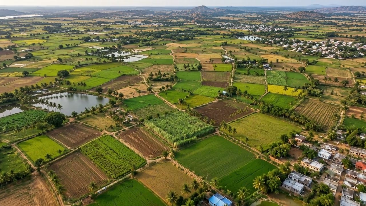
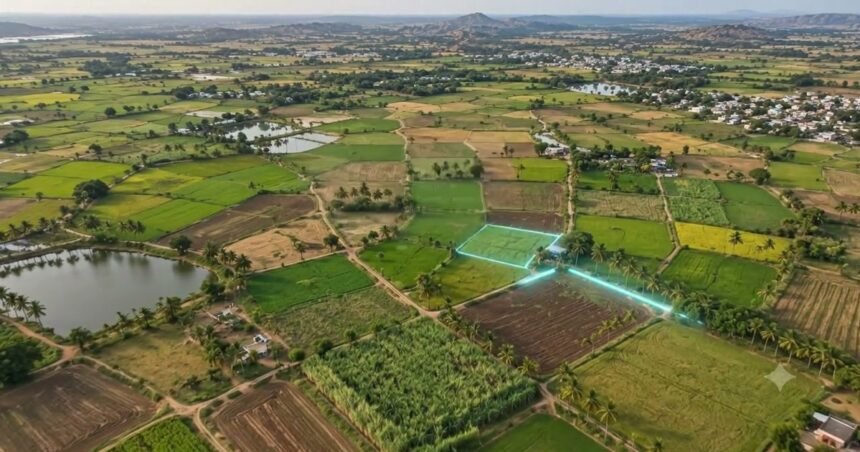
FarmwiseAI’s GeoAI platform draws digital boundaries over real farmland. (Official visual: FarmwiseAI)
The six-month mapping of a state
Tamil Nadu set out to give every farm a digital identity, linked to its owner and its attributes. FarmwiseAI won the tender with an approach that pairs artificial intelligence with geographical information systems, taking the state’s Field Measurement Book records and fixing each subdivision to real-world coordinates. The company says the work cost 46 per cent less than the manual process, and connected more than 95,000 stakeholders and over ten government bodies along the way.
What that unlocks goes far beyond a tidier record book. Once every parcel is fixed to coordinates, the same platform can read the land from above — identifying crops, tracking how they grow, and turning satellite and drone intelligence into advice a farmer can actually use. The company says its in-house agriculture models predict crop types and crop growth stages from satellite images, with advisories linked to weather reports so guidance arrives timed to the conditions in each farmer’s own fields.
More Read

The farmland FarmwiseAI’s platform maps, from above. (Official visual: FarmwiseAI)
Reading crops from space
The platform behind the mapping is what FarmwiseAI calls GeoAI: satellite imagery, drone intelligence and land records fused into one decision system for governments and enterprises. Through Agri-X, the company gives researchers satellite data on demand, in the format they need. Through Farmplotter, it classifies and plots agricultural land automatically, using land records and geospatial intelligence. And through two apps built with Tamil Nadu Agricultural University — M-Velanmai and AgriCart — the technology reaches farmers directly: M-Velanmai uses AI to detect pests from a photo of the crop, with experts from the university advising on protection, while AgriCart connects farmers with buyers, crop inputs, tractors, drones and on-demand services.
Here’s the company’s own film of its GeoAI platform at work over Tamil Nadu’s farmland:
From the field to the bank, the factory and the city
The same intelligence that mapped a state’s farms is now being put to work far beyond agriculture. For the State Industries Promotion Corporation of Tamil Nadu (SIPCOT), FarmwiseAI’s platform identifies land, provides owner details and creates feasibility reports, helping the corporation offer land to industry, arrange power and water, and monitor how each industrial park develops. With Karur Vysya Bank, backed by the Department of Science and Technology, the company is running a remote farmland verification pilot that brings geospatial intelligence to agricultural lending and insurance — evidence-based decisions, built with Tamil Nadu Agricultural University.
The work has already spread beyond Tamil Nadu. FarmwiseAI now works with multiple government departments in Telangana, and is in talks with the Maharashtra and Uttar Pradesh governments for new projects. Its partners include AI Singapore, Amazon Web Services and NABARD, and it also works with ITC, the University of Twente and Kerala’s KELTRON. What began as AI for farmers now stretches across water, mining, agri finance, education, lands and cities.
A meeting on the metro
On 21 October 2026, founder Anand Vetrivel presented the company’s work to Prime Minister Narendra Modi aboard Chennai’s new Yellow Metro line. The Prime Minister asked a string of technical questions, and asked whether the mapping could be done on an all-India basis — then offered Vetrivel an opportunity to pitch his plans at his office. For a company launched six years ago to bring AI and GIS together to solve real-time problems, it was a remarkable moment: the technology that mapped one state’s farms, presented as a model for the whole country.
What comes next
FarmwiseAI’s rise has been recognised at home, too: the company won the iTNT Hub’s Geospatial Innovation Challenge in 2025, and was named among LinkedIn’s Top Startups in Chennai for 2026. The 40-million-parcel map was the proof; the ambition now is to take the same GeoAI engine to every state that will have it, and to keep pushing it into the places where a digital map of the land changes what a government, a bank or a farmer can decide. Tamil Nadu’s farms are on the map now — all forty million of them — and that map is only the beginning.
Keep reading: Seven Minutes an Acre: Inside Vaimanika Aerospace, the Patna Startup Spraying India’s Fields by Drone · The Robot That Weeds, Seeds and Sprays on Its Own: Inside Pragyanik AI, the Indore Startup Building Farm Robots for India’s Small Farms · More Food Processing & Agri-Tech stories
Like stories like this? Add Exceptional Technology as a preferred source on Google to see more of our reporting in your search results and Discover feed.